 Comparison Tests
In September 2012, Apple jettisoned Google Maps from its iOS 6 operating system and a maelstrom ensued. Users complained, refusing to update their devices, and Apple CEO Tim Cook soon apologized. The tech giant’s stock plummeted from over $700 per share to $419 in six months. While hardly the sole cause of Apple’s Wall Street woes, Google Maps is undeniably the 800-pound gorilla of navigation. It helps us eke out seconds to grab a latte between just-in-time deliveries of child, spouse, and family materiel. And its turn-by-turn directions for driving, public transit, and walking gave us an idea: We’d compare all three and find out what lies behind those two other buttons we never press.
The obvious problem was how to level the playing field so each method had an equal chance to prove its mettle. So we chose to pit car against public transportation against foot power in New York City, an environment equally hostile to all.
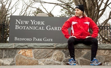
We settled on a trip from the New York Botanical Garden in the Bronx to Battery Park near the southern tip of Manhattan. Stopping for a hot dog at a Papaya King near the halfway point would add a 20-minute layer of complication. Bentley obliged us with a $302,425 Mulsanne for the driving portion, while Google indicated that the best transit route would include both bus and subway stints via the Metropolitan Transportation Authority. And for what was nominally a walking trip, I decided to lace up a new pair of running shoes, vowing to complete what would amount to my first half-marathon in more than a year.
I made the car and transit trips during the morning rush, while the journey on foot took most of an afternoon. I was wired with a heart-rate monitor and a GPS watch, but the measuring tools were overshadowed by my notebook. Indeed, the point was less about the competition than actually learning something about getting around.
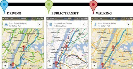
Such as, no matter where you’re going, it always takes more time than expected. None of my trips hit its projected travel time, with the MTA spitting me out in view of the Statue of Liberty some 26 minutes behind schedule and the Bentley arriving 37 minutes “late.” While my run nearly halved Google’s projected walking time, it was still nearly 50 minutes slower than my last race finish, a pace well below the explanations offered by the extra 0.6-mile of distance, a frankfurter-laden belly, and insufficient training.
But the real lesson of this comparo is that no matter the method of transportation, they all work in a symbiosis that keeps New York moving. Over the three days spent racing up and down the Bronx and Manhattan for this story and its accompanying photos, the Bentley was supplanted by numerous cabs and livery vehicles, an unlimited-use MTA pass all but paid for itself in savings, and my shoes got broken in even before my run. The streets of the city demanded it.