 Kevin McNulty
Former Editor, Mud Life
Kevin McNulty
Former Editor, Mud Life
As automotive-adventure photojournalists we're always on the go, so knowing where we are, where we've been, and where we need to be is a critical part of our job. Many times we've been given coordinates where to meet someone, rather than a physical street address. This makes a dependable and accurate GPS essential gear.
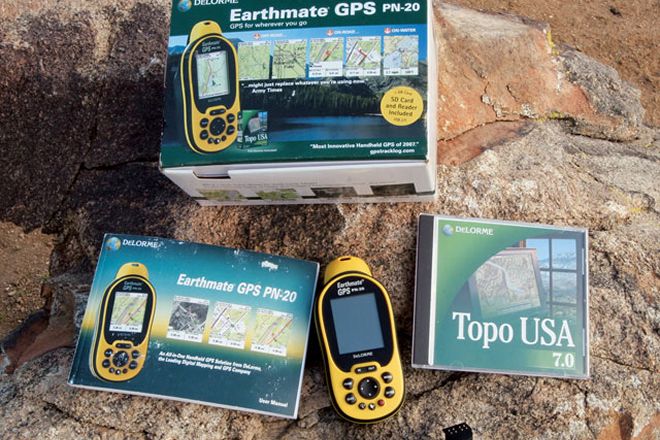
The new DeLorme Earthmate GPS PN-20 is easy to use for those who aren't so technically inclined, and it has all the advanced features a high-tech geek could ever want. The rugged and waterproof handheld GPS features a bright color screen that works in sunlight or total darkness. This makes the PN-20 easy to read when entering and exiting a vehicle, and we found that we didn't needed to shade the screen to figure out where we were located.
The coolest part of the PN-20 is the unit's ability to download different types of detailed mapping. It comes with DeLorme's Topo USA and features nationwide street-level mapping for major roads and highways, the latest topographical maps for easy navigation of back roads and trails, authentic USGS in 7.5-min detail, color aerial imagery, and NOAA nautical charts. The PN-20 has automatic road routing with turn-by-turn directions, and four million places of interest. The unit can also track your travels with breadcrumbs for future reference and navigation.


